Understanding Bentarum’s Landscape
Explore the villages, habitats, and land-use patterns that shape this vital landscape
Landscape Dynamics of Bentarum
Bentarum doesn’t have defined borders. Sangga Bumi focuses on a 326,862-hectare area between Danau Sentarum National Park in the south to Betung Kerihun National Park in the north. Our western border runs along the village of Sepandan in the south to Setulang in the north. Our eastern border runs from Melemba in the south, up to Sungai Uluk Palin.

Villages
There are 26 villages within the Bentarum corridor. These villages are home to approximately 14,284 people. Most people in Bentarum are indigenous Dayak Iban and Dayak Tamanbaloh, with smaller populations of Dayak Kantuk. There are also small populations of non-indigenous Malayu. Most of Bentarum’s residents identify as Catholic.
Habitat Types
Bentarum can be roughly divided into six major habitat types:
- Undisturbed Peat Swamp, covering 86,764.2-hectares
- Disturbed Dry Lowland, covering 80,975.78-hectares
- Undisturbed Dry Lowland, covering 86,172.66-hectares
- Freshwater Swamp, covering 28,746.23-hectares
- Mixed Agriculture, covering 27,811.6-hectares
- Disturbed Peat Swamp, covering 16,392.11-hectares
Land Categories
Land in Indonesia is divided into areas that must remain forested (the Forest Estate, or Kawasan Hutan) and land designated for industrial use (Areas for Other Purposes, or Areal Penggunaan Lain, often abbreviated to APL).
Land Uses
There is one existing Customary Forest (Hutan Adat) in Bentarum, the 9,480.4-hectare Sungai Utik in the village of Batu Lintang. Sangga Bumi is advancing 10 Hutan Adat applications in 10 villages covering 98,776.68-hectares. There are at least nine additional Hutan Adat applications known to be in progress.
There are 12 Village Forests (Hutan Desa) in Bentarum, covering 49,716-hectares.
Concessions
Forest Utilization Business Permits
In Kawasan Hutan, three companies operate Forest Utilization Business Permits. These are understood to be for the eventual development of carbon credit projects
Oil Palm Concession
Within the APL, one company operates an oil palm concession
Wildlife
Bentarum is a biodiversity hotspot. Its mosaic of lowland dipterocarp and peat swamp forests hold extraordinary mammal diversity, including orangutans, gibbons, langurs, macaques, tarsiers, slow lorises, sun bears, and four of Kalimantan’s five small cats.
Sangga Bumi prioritises three species:
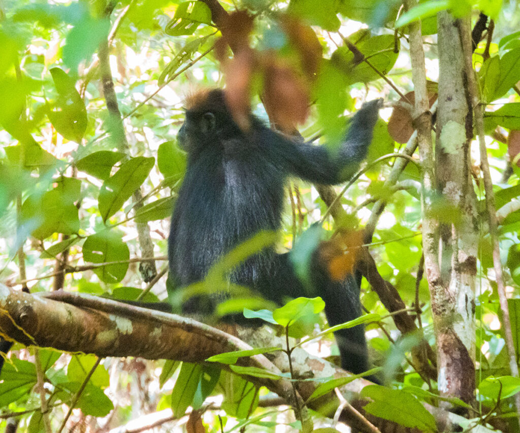
The Critically Endangered Tricolour langur (Presbytis chrysomelas cruciger)

The Endangered Abbott’s gibbon (Hylobates abbotti)
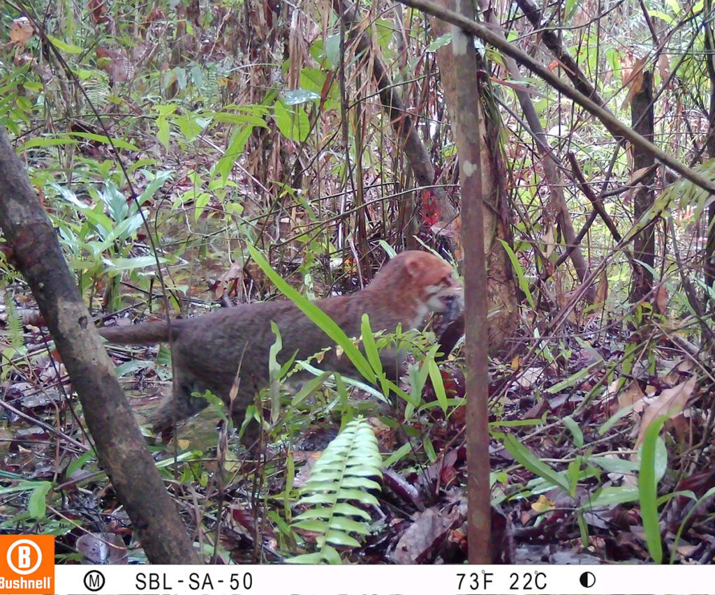
The Endangered flat-headed cat (Prionailurus planiceps)